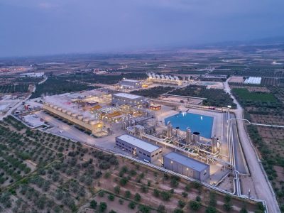
Argentina region of Mendoza opens 14 geothermal reserve areas
The government of Argentina province Mendoza has declared 14 reserve areas of geothermal interest that covers more than 90,000 Hectares.
Sent in from Argentina, “The government of Argentina province Mendoza has declared 14 reserve areas of geothermal interest that covers more than 90,000 Hectares. (complete text of decree in Spanish below)
According to the Argentinean Mining Code the government has the right to reserve the natural resource for a limited period of time of 2 year. Within the 2 years the government has to make base studies to lease the blocks in an open and international bid.
With the Decree 301 of the Mining Department of Mendoza Province, along with the national law to promote renewable energy, both the National and Provincial Administrations are showing their commitment to the development of renewable energies, including geothermal.
The National Promotion Direction (DNPROM) within the Energy Secretariat (SENER) is responsible for the design of programs and actions conducive to the development of renewable energies (through the Renewable Energy Coordination) and energy efficiency (through the Energy Efficiency Coordination) initiatives.
Complementarily, the Secretariat for the Environment and Natural Resources (SEMARNAT) is responsible for environmental policy and the preservation of renewable and non-renewable resources.
The most important legal instruments for the promotion of renewable energy are Law 25,019 from 1998 and Law 26,190 from 2007.
The 1998 law, known as the “National Wind and Solar Energy Rules”, declared wind and solar generation of national interest and introduced a mechanism that established an additional payment per generated kWh which, in 1998, meant a 40% premium over market price. It also granted certain tax exemptions for a period of 15 years from the law’s promulgation.
The 2007 Law complemented the previous one, declaring of national interest the generation of electricity from any renewable source intended to deliver a public service. This law also set an 8% target for renewable energy consumption in the period of 10 years and mandated the creation of a trust fund whose resources will be allocated to pay a premium for electricity produced from renewable sources.
The Genren Program
In May 2009, the Federal Secretariat of Energy launched the ‘Genren Program’. The aim of this program is to incorporate 1,000 mW to the MEM by purchasing power from renewable energy plants.
These 1,000 mW shall be composed as follows:
- Bio-fuels energy: 150 mW.
- Urban garbage energy: 120 mW.
- Biomass energy: 100 mW.
- Small hydroelectric energy plants: 60 mW.
- Geothermal energy: 30 mW.
- Solar energy: 20 mW.
- Biogas energy: 20 mW.
- Wind energy: 500 mW.
Each renewable energy project may contribute to the program up to 50 mW (when applicable).
The purchase of electricity will be put out to tender by Energ?´a Argentina SA (ENARSA, a state-owned energy company) and shall be implemented through a 15-year supply contract.
To qualify for this program, the energy offered to ENARSA must be produced by electricity plants linked to the Argentine Interconnected System (Sistema Argentino de Interconexio´n or SADI), so that energy production goes to the MEM or to electricity distributors. In order to stress The Genren Program, the Secretariat of Energy enacted Decision 712/ 2009 which authorized Energy Supply Contracts between the MEM and those ‘renewable energy offers’ presented by ENARSA, under the Genren Program.
Thanks to Gustavo Racioppi from GE to send this in.
Tema AREAS DE RESERVA GEOTERMAL
Tipo IRRIGACION Y MINAS
Publicación 3 veces: 23/09/10, 30/09, 13/10
Ref. Expte. N° 301/M/2010 – 01583 – caratulado: MINERA DIRECCION DE.
S/AREAS DE RESERVA GEOTERMAL PROVINCIALES.
A fojas 02/05 por Resolución N° 99 de fecha, Mendoza 23 de
agosto de 2010, la Directora de la Dirección de Minería de
la Provincia de Mendoza, Resuelve:
Artículo 1° – Declarar 14 (catorce) Áreas de
Interés Provincial y Áreas de Reserva Geotermal, por el
término de dos (2) años, en los Departamentos de
Malargüe, San Rafael, Tunuyán, Rivadavia, Luján de
Cuyo, Las Heras y Lavalle, las zonas que se delimitan en el
artículo tercero, de acuerdo a los linderos y medidas perimetrales
que se detallan en el plano y anexo adjuntos a la presente
resolución.
Artículo 2° – Objeto: La reserva territorial geotermal se
establece con el propósito de que la Autoridad Minera desarrolle
tareas de prospección y exploración (artículo 346 y
consecuentes del Código de Minería de la Nación) de
los denominados “vapores endógenos” y recursos
geotermales en general, perteneciente a la primera categoría,
según el inciso – e – del Artículo 3º del mismo texto
legal.
Artículo 3° – Extensión y Límites: El
área de reserva que será objeto de investigación
abarca una superficie total de 91.868,89 hectáreas, distribuida en
catorce sectores cuyos límites expresados en coordenadas Gauss –
Krugger forman parte del Anexo I.
Artículo 4° – Plazos: Durante el plazo establecido de dos (2)
años, la Autoridad Minera Provincial no admitirá pedimentos
de terceros, referidos a las sustancias objeto de la investigación,
salvo los originados en permisos o concesiones anteriores o en
trámite.
Artículo 5° – Administración y autoridad de
aplicación. La Administración de las Áreas de Reserva
enumeradas en el Anexo I, será efectuada en forma directa a
través de la Dirección de Minería de la Provincia de
Mendoza, que además estará a cargo de la supervisión
y coordinación de todas las tareas geológicas y ambientales
a desarrollarse en la zona.
Artículo 6° – Convenios. La Autoridad Minera tendrá la
plena libertad de celebrar los Convenios y/o Acuerdos necesarios a los
efectos del cumplimiento de las tareas de prospección y
exploración geológicas a desarrollarse en las áreas
reservadas.
Artículo 7° – Regístrese, publíquese en el
Boletín Oficial por tres veces en el término de quince
días. Comuníquese y tome intervención Registro
Gráfico.
Fdo. Adriana Blesa – Directora – Dirección de Minería –
Gobierno de Mendoza
ANEXO I
ÁREAS DE RESERVA GEOTERMALES (ARG) – Coordenas Gauss-Krugger
Área de Reserva 1, Zona Cajón Grande del Campanario,
Departamento Malargüe, Superficie: 6.524.52 hectáreas
Punto 1: x= 6.017.827,42 y= 2.379.787,679
Punto 2: x= 6.025.489,337 y= 2.379.432,096
Punto 3: x= 6.025.489,337 y= 2.388.125,407
Punto 4: x= 6.017.827,42 y= 2.388.125,407
Área de Reserva 2, Zona Cordón del Cura, Departamento
Malargüe, Superficie: 14.115,71 hectáreas
Punto 1: x= 6.108.200 y= 2.373.262,735
Punto 2: x= 6.107.204,863 y= 2.372.653,889
Punto 3: x= 6.106.232,68 y= 2.371.745,223
Punto 4: x= 6.105.268,328 y= 2.370.111,959
Punto 5: x= 6.104.100 y= 2.369.850
Punto 6: x= 6.096.100 y= 2.369.850
Punto 7: x= 6.096.100 y= 2.370.718,22
Punto 8: x= 6.092.000 y= 2.370.718,22
Punto 9: x= 6.092.000 y= 2.374.000
Punto 10: x= 6.084.500 y= 2.374.000
Punto 11: x= 6.084.500 y= 2.376.951,259
Área de Reserva 3, Zona Cerro de la Lagunita, Departamento
Malargüe, Superficie: 9.593,68 hectáreas
Punto 1: x= 6.102.050 y= 2.393.300
Punto 2: x= 6.099.500 y= 2.393.300
Punto 3: x= 6.099.500 y= 2.386.831
Punto 4: x= 6.108.200 y= 2.386.831
Punto 5: x= 6.108.200 y= 2.383.400
Punto 6: x= 6.112.200 y= 2.383.400
Punto 7: x= 6.112.200 y= 2.383.500
Punto 8: x= 6.112.500 y= 2.383.500
Punto 9: x= 6.112.500 y= 2.386.000
Punto 10: x= 6.112.500 y= 2.398.462
Punto 11: x= 6.108.000 y= 2.398.462
Área de Reserva 4, Zona El Peralito, Departamento Malargüe,
Superficie: 3.279,07 hectáreas
Punto 1: x= 6.096.000 y= 2.414.600
Punto 2: x= 6.103.000 y= 2.414.609,344
Punto 3: x= 6.103.023,976 y= 2.419.280
Punto 4: x= 6.096.000 y= 2.419.282,101
Área de Reserva 5, Zona Los Molles, Departamento Malargüe,
Superficie: 5.790,64 hectáreas
Punto 1: x= 6.110.500 y= 2.403.000
Punto 2: x= 6.113.420,253 y= 2.403.000
Punto 3: x= 6.113.420,25 y= 2.417.802,118
Punto 4: x= 6.103.016,39 y= 2.417.802,118
Punto 5: x= 6.103.006,326 y= 2.415.841,753
Punto 6: x= 6.110.500 y= 2.415.841,753
Área de Reserva 6, Zona El Sosneado, Departamentos San Rafael y
Malargüe, Superficie: 8.095,52 hectáreas
Punto 1: x= 6.150.315,49 y= 2.406.009,63
Punto 2: x= 6.147.756,54 y= 2.406.009,63
Punto 3: x= 6.146.700 y= 2.408.300
Punto 4: x= 6.143.500 y= 2.408.300
Punto 5: x= 6.143.500 y= 2.405.000
Punto 6: x= 6.138.000 y= 2.405.000
Punto 7: x= 6.138.000 y= 2.412.825,25
Punto 8: x= 6.150.315,49 y= 2.412.825,85
Área de Reserva 7, Zona Baños del Alto y Alto Verde,
Departamento Tunuyán. Superficie: 6.302,29 hectáreas
Punto 1: x= 6.298.879,95 y= 2.493.672,09
Punto 2: x= 6.288.705,441 y= 2.493.672,09
Punto 3: x= 6.288.705,441 y= 2.503.300,007
Punto 4: x= 6.292.545,536 y= 2.503.300,007
Punto 5: x= 6.292.545,536 y= 2.500.335,675
Punto 6: x= 6.294.722,595 y= 2.500.335,675
Punto 7: x= 6.294.722,595 y= 2.496.433,647
Punto 8: x= 6.298.925,551 y= 2.496.433,647
Área de Reserva 8, Zona Cacheuta – Potrerillos, Departamento
Luján de Cuyo. Superficie: 4.281,46 hectáreas
Punto 1: x= 6.345.252,03 y= 2.483.268,46
Punto 2: x= 6.342.794,149 y= 2.483.268,46
Punto 3: x= 6.342.794,149 y= 2.478.022,662
Punto 4: x= 6.350.428,492 y= 2.477.970,686
Punto 5: x= 6.351.264,79 y= 2.482.284,65
Punto 6: x= 6.350.707,37 y= 2.483.115,65
Punto 7: x= 6.349.750,21 y= 2.483.877,35
Punto 8: x= 6.345.252,03 y= 2.483.268,46
Punto 9: x= 6.349.300 y= 2.483.925
Punto 10: x= 6.348.500 y= 2.483.300
Punto 11: x= 6.347.751,479 y= 2.483.199,607
Punto 12: x= 6.346.801,955 y= 2.482.829,774
Área de Reserva 9, Zona Cerro Cacheuta, Departamento Luján
de Cuyo. Superficie: 1.927,9 hectáreas
Punto 1: x= 6.347.475,37 y= 2.484.026,34
Punto 2: x= 6.347.877,51 y= 2.483.998,35
Punto 3: x= 6.348.171,89 y= 2.483.940,56
Punto 4: x= 6.348.913,384 y= 2.484.376,142
Punto 5: x= 6.349.567,385 y= 2.484.760,327
Punto 6: x= 6.349.073,24 y= 2.487.146,8
Punto 7: x= 6.349.787,409 y= 2.488.000
Punto 8: x= 6.344.000 y= 2.488.000
Punto 9: x= 6.342.793,614 y= 2.488.000
Punto 10: x= 6.342.863,137 y= 2.486,707,166
Punto 11: x= 6.342.988,566 y= 2.486.120,405
Área de Reserva 10, Zona Baños de Zapata – El
Borbollón, Departamento Las Heras. Superficie: 10.000
hectáreas
Punto 1: x= 6.370.513,24 y= 2.515.299,579
Punto 2: x= 6.380.513,238 y= 2.515.299,579
Punto 3: x= 6.380.513,238 y= 2.525.299,578
Punto 4: x= 6.370.513,24 y= 2.525.299,578
Área de Reserva 11, Zona Muli Asri, Departamento Lavalle.
Superficie: 8.500,77 hectáreas
Punto 1: x= 6.403.201,149 y= 2.616.661,84
Punto 2: x= 6.413.201,146 y= 2.616.661,84
Punto 3: x= 6.413.201,146 y= 2.625.019,627
Punto 4: x= 6.403.201,149 y= 2.625.305,595
Área de Reserva 12, Zona Puente del Inca, Departamento Las Heras.
Superficie: 4.834,37 hectáreas
Punto 1: x= 6.373.001,254 y= 2.413.409,004
Punto 2: x= 6.373.434 y= 2.417.035,745
Punto 3: x= 6.364.702,46 y= 2.417.035,745
Punto 4: x= 6.364.702,46 y= 2.409.500
Punto 5: x= 6.367.293,871 y= 2.409.500
Punto 6: x= 6.367.279,14 y= 2.409.715,54
Punto 7: x= 6.368.471 y= 2.409.908
Punto 8: x= 6.368.566 y= 2.410.655
Punto 9: x= 6.368.358,829 y= 2.411.364,151
Punto 10: x= 6.368.986,006 y= 2.412.263541
Área de Reserva 13, Zona Yalguaraz, Departamento Las Heras.
Superficie: 5.161,32 hectáreas
Punto 1: x= 6.442.740 y= 2.450.000
Punto 2: x= 6.442.740 y= 2.452.500
Punto 3: x= 6.445.400 y= 2.452.500
Punto 4: x= 6.445.400 y= 2.457.100
Punto 5: x= 6.441.300 y= 2.457.100
Punto 6: x= 6.441.210 y= 2.458.750
Punto 7: x= 6.437.400 y= 2.458.800
Punto 8: x= 6.442.740 y= 2.450.000
Punto 9: x= 6.437.400 y= 2.452.500
Punto 10: x= 6.437.400 y= 2.452.000
Punto 11: x= 6.438.789 y= 2.452.000
Punto 12: x= 6.438.789 y= 2.452.500
Área de Reserva 14, Zona Lomas Bayas, Departamento Las Heras.
Superficie: 3.461,65 hectáreas
Punto 1: x= 6.445.400 y= 2.465.000
Punto 2: x= 6.452.320,885 y= 2.465.000
Punto 3: x= 6.451.862,946 y= 2.466.006,725
Punto 4: x= 6.451.268,964 y= 2.466.774,511
Punto 5: x= 6.450.928,546 y= 2.467.399,509
Punto 6: x= 6.450.618,15 y= 2.468.209,955
Punto 7: x= 6.450.327,085 y= 2.469.309,506
Punto 8: x= 6.449.925,499 y= 2.470.259,476
Punto 9: x= 6.450.266,579 y= 2.470.588,457
Punto 10: x= 6.450.680,117 y= 2.470.685,214
Punto 11: x= 6.450.816,738 y= 2.470.921,23
Escribanía de Minas
Dirección de Minería – Gobierno de Mendoza
Mendoza, Setiembre 22 de 2010.
Fernando A. Calderón, Escribano
23/30/9 y 13/10/2010 (3 P.) S/Cargo


